
-
Description
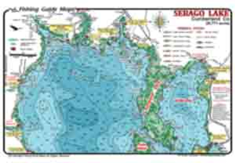
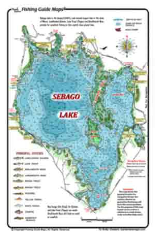
Sebago Lake is 0ver 28,000 acres for deep, multi-species fishing in Cumberland County, in southwest Maine, northwest of Portland, Maine. Many boat ramps allow you to launch for a day of clear water fishing for Salmon, Trout, Bass, and Panfish. From Sebago Lake State Park enjoy fishing and exploring the islands, points and coves. Crooked Lake and Brandy Pond join Sebago Lake to Long Lake.
- Best fishing sites are marked on the single-sided map.
- Map details include lake contours and depths, islands, buoys, islands, sand and rock shoals, ramps.
- Waterproof, colorful and easy to read map.
Get your Sebago Lake maps online today and save.